How Spread Out Is the U.S. Population?
The U.S. contains more than 3,000 counties and has about 327 million inhabitants. About half of those people live in a mere 140 counties.
In a recent Economic Synopses essay, Deputy Director of Research B. Ravikumar and former Research Associate Ryan Mather examined the distribution of the U.S. population across counties. They noted that the county with the most inhabitants—Los Angeles County—is so large that it would be the 10th largest state in the U.S. in terms of population.
Most Populous Counties
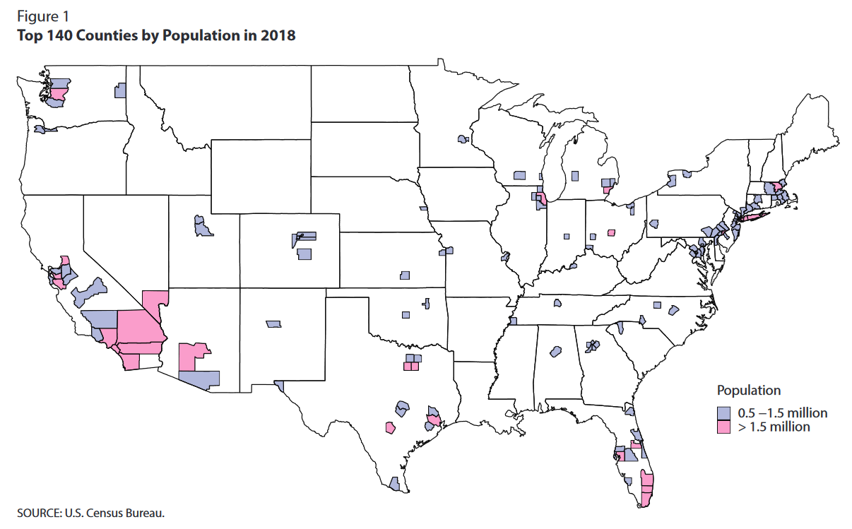
The figure below shows the U.S.’s 140 most populous counties, which account for half the nation’s population. “For some perspective on the land area, consider that all 140 of these counties would fit into California and Florida—with space to spare,” Ravikumar and Mather wrote.

Geographic Distribution of the U.S. Population
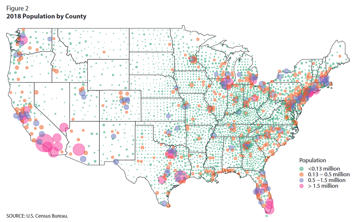
In addition to looking at the largest counties, the authors examined how the population is distributed throughout the U.S. In the figure below, the authors showed population density per county. The size of each circle corresponds to population size, and the color of each circle corresponds to a group of counties representing approximately 25% of the population. (For example, the sum of the populations in the counties represented by a green circle would total about 25% of the U.S. population.)

Additional Resources
- Economic Synopses: Geographic Disparity in the U.S. Population
- On the Economy: U.S. Population Growth Slowing to a Crawl
- On the Economy: Domestic Migration Is Driving Population Growth in U.S. Cities
Citation
ldquoHow Spread Out Is the U.S. Population?,rdquo St. Louis Fed On the Economy, June 22, 2020.
This blog offers commentary, analysis and data from our economists and experts. Views expressed are not necessarily those of the St. Louis Fed or Federal Reserve System.
Email Us
All other blog-related questions

