

St. Louis Fed’s GeoFRED Receives Several Enhancements
Editor's note: GeoFRED is sunsetting in 2022. You can now customize, share and download geographical maps of data directly in FRED Maps.
The Federal Reserve Bank of St. Louis has made a number of enhancements to GeoFRED. Foremost among the upgrades is an enhanced homepage and user interface.
GeoFRED—an extension of the St. Louis Fed’s popular FRED (Federal Reserve Economic Data) database—allows users to map many FRED data series at the state, county and metropolitan statistical area levels. With the new GeoFRED, users can now map international data as well.
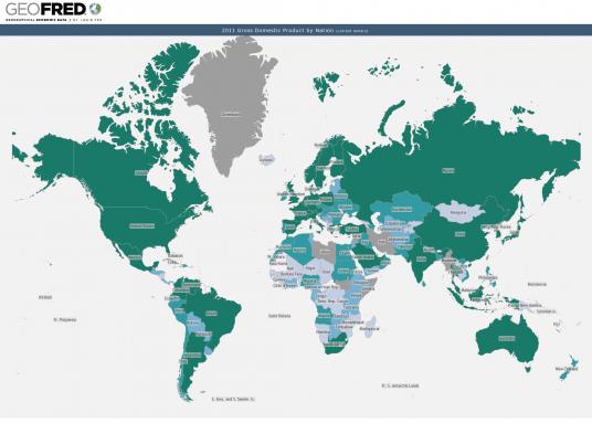
The new GeoFRED platform features an intuitive design, including double-click map zooms and tools menus. Users can also get data readings of a particular series by simply hovering their cursor over specific geographic areas, such as countries, states and MSAs. The tools menu is located in the upper right-hand corner of every map and allows users to change the data and presentation of the map.
The new site also contains blog posts and tutorials to help users get the most out of GeoFRED.
This blog offers commentary, analysis and data from our economists and experts. Views expressed are not necessarily those of the St. Louis Fed or Federal Reserve System.
Email Us
All other blog-related questions
